


Geographic data:
From a geographic point of view, Lipova is situated at the intersection of 46°6’15” north latitude and the meridian of 21°41’15” east longitude.
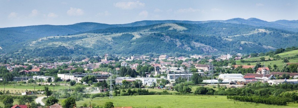
Lipova is a town situated in the Arad County, the regions of Banat and Crisana, Romania, made up from the reunion of three old small towns: Radna and Soimos, on the right bank of the river Mures and Lipova, on its left bank. It has a population of 10.313 inhabitants (2011).
The town is situated on both banks of river Mures, at its entrance in the Arad Field, at the foothills of the Zarand Mountains, in the contact area of the latter with Lipova Hills. The distance between Lipova and Arad, which is situated to the west, is of 34 kilometers. The town of Lipova is at an equal distance from the westernmost point of the Arad county (Nadlac) and the eastern one (Zamul).
The area of Lipova is of 14,790km2. The area outside of settlement is of 129km2.
The climate of the area can be defined as moderate temperate continental climate with oceanic influences.
Its vegetation consists of:
• oak, Turkey oak, Hungarian oak, common oak forests, those which are often in the Zarand Mountains and Lipova Hills
• the steppe vegetation from Mures meadow
Short history:
The first documentary attestation of Lipova town dates from the year 1314, under the name of Lipva. During the year 1324 the settlement is mentioned under the name of castellanus de Lypua, a toponymic name which reflects the fortified character of the site at that time.
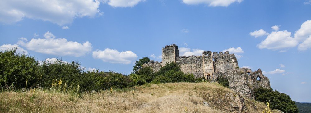
Within the area of the town as of today, tourists can visit the Soimos Fortress, which was built during the reign of Bela the 4th (1235 – 1270). The first documentary mentioning goes back to 1245, in which the king gave order that the fortress, which was destroyed by the Tartar invasion in 1241, to be rebuilt. The Soimos Fortress disappeared after the middle of the 16th century, together with most of the interior medieval constructions, out of which, certainly, the parish church and the monastery, dedicated to the Saint Louis of Toulouse, Carol Robert de Anjou’s uncle.
On the territory of the town of Lipova some traces of some old Neolithic, Dacian and Roman settlements have been discovered, which prove the presence of earlier human traces.
During 1315, this settlement appears mentioned under the name of Lipva, and during 1440 it is declared independent town. During 15th century, the fortress belonged to the Huns.
Being situated on the river Mures, in the northern part of Banat region, Lipova was claimed both by the Habsburgs and Ottomans. Between 1552 – 1595 and 1613 – 1718, the town was interruptedly ruled by the Turks. As a result of signing the Treaty of Passarowitz in 1718, the town returned permanently in the hands of the Habsburgs. Nevertheless Lipova is one of the few towns ruled by the Turks in which one can still find their traces, the Turkish Bazaar being representative in this respect.
During 1918, the deputies of Banat region headed by Sever Bocu, proclaim the union of Banat region with Romania (the border with Serbia will be drawn by the commission run by the French geographer Emmanuel de Martonne, who also drawn the Romanian – Hungarian border). But in 1919, the Hungarian – Bolshevik army of Bela Kun tries to reconquer the region and is defeated by the Romanian – French army lead by generals Prezan and Berthelot. Some other fights will take place in the area during September 1944 between the German and Romanian Armies.
Home / About Lipova
About Lipova
Copyright © 2024, Centrul de Informare Turistică Lipova. Proudly powered by WordPress. Blackoot design by Iceable Themes.